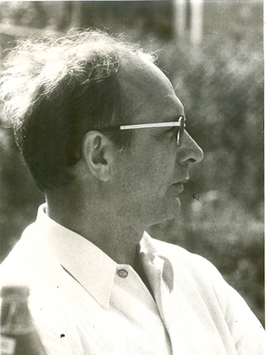
Dr.-Ing. Walter Seele
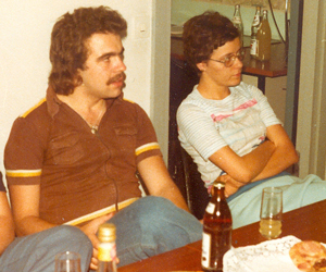
The first professors of the Department of Spatial Planning at the TU Dortmund University - among them the full university professor Dr.-Ing. Walter Seele - took up their duties in December 1968 (Junius 1976: 198). However, the founding chair "Bodenordnung und Vermessungswesen" (VBO) at the Department of Spatial Planning at the TU Dortmund University did not begin with research and teaching until the summer semester of 1969. In the spirit of the 1968 movement, the term "department" was initially used instead of "chair" and "department". Brigitte Hower, who was a member of the chair from 1969 to 2008, was there from the beginning. As secretary, office coordinator and guardian angel, she supported three professors (Seele, Dieterich, Davy) and numerous generations of scientific, technical and student employees. Ms. Howers' recollections and other accounts (including Junius 1976; Lucht 2014; Dieterich 2002) form the basis for this departmental history, which spans the period of 50 years.
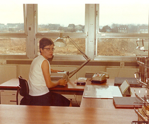
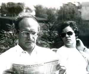
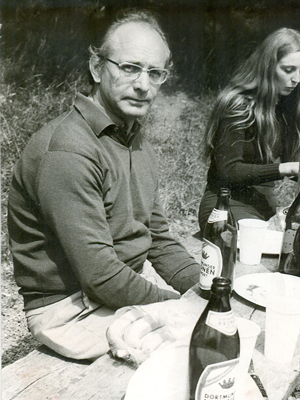
The first professor at the founding chair VBO was Dr.-Ing. Walter Seele together with Brigitte Hower. Walter Seele was born in Minden in 1924 and was severely wounded as a soldier in the German Wehrmacht in Ukraine (this and subsequent information comes from Lucht 2014). His geodesy studies at the University of Bonn, supplemented by courses in economics and social sciences, lasted from 1946 to 1950. After his legal clerkship, Walter Seele earned his doctorate under Professor Gaßner with a dissertation on urban planning and land value formation. Between 1956 and his appointment to the University of Dortmund, Walter Seele was head of the Surveying and Cadastral Office in Wattenscheid and the Surveying Office of the City of Nuremberg. Seele worked at the University of Dortmund from 1968 to 1975, and in 1971 and 1972 he held the office of dean together with surveying technician Brigitte Bergmann.
Seele and his scientific staff - women played only serving roles at VBO at that time - taught geodetic knowledge and skills to spatial planning students, a scientific and didactic challenge for which there were no role models in the Federal Republic of Germany. New ground was broken every day. The core program of VBO included land readjustment (property law, surveying law, implementation instruments under urban planning law), land value assessment, planning cartography, theories of land value formation, fundamentals of land policy and land economics, aerial photo evaluation (Junius 1976: 199). Based on the building law opinion of the Federal Constitutional Court from 1954 (BVerfGE 3, 407), the urban planning law implementation instruments form important elements of urban land use planning in Germany. Land readjustment, land value assessment and planning cartography also form the core of municipal surveying (Stahr 2006). In the early years of the founding chair, there was still a deep conviction that spatial developments could be sensibly controlled by the use of regulatory instruments (such as official building land reallocation or expropriation). Walter Seele knew how to combine the regulatory approach of the Federal Building Code with knowledge and skills in soil economics and geodesy. In this way, he created the basis for an interdisciplinary oriented land policy, which he further developed after his appointment to the chair of "Bodenordnung und Bodenwirtschaft" at the Institute for Urban Development, Land Planning and Cultural Engineering at the University of Bonn in 1975 (for Walter Seele's rich publications, see the selection in Borchard & Weiß 1994; especially typically Seele 1997; see also Lucht 2014).
The VBO chair was endowed with five positions for research assistants. Walter Seele's scientific staff included two of the most important "influencers" of the German valuation scene to this day: Dr.-Ing. Hans Otto Sprengnetter and Ministerialrat a.D. Dipl.-Ing. Wolfgang Kleiber (honorary professor at the Anhalt University of Applied Sciences). Sprengnetter Immobilienbewertung (www.sprengnetter.de) is one of the largest offices for property valuation in Germany. The professional journal "Grundstückswert und Grundstücksmarkt" (GuG), published by Wolfgang Kleiber together with Brigitte Hower, as well as his handbook "Verkehrswertermittlung von Grundstücken" (Determination of the Market Value of Real Estate), published in its 8th edition in 2017, are standard equipment for all experts in real estate valuation.
The geodesist and later senior academic councilor Dr.-Ing. Hartwig Junius, at the chair from 1969 to 2004, had a formative influence on the chair. He took up his post on October 1, 1969, at the same time as the birth of a daughter. Junius taught primarily planning cartography and aerial photo interpretation, as well as surveying (for students of the neighboring faculty of civil engineering) and graphic data processing. As a senior academic advisor, Junius regularly contributed about 16 hours per week to teaching each semester, which allowed the VBO offerings to be generous and rich in content (in terms of content and in terms of course types). Junius earned his doctorate in 1980 with a thesis entitled "A Digital Topographic Map for Land Use Planning - A Proposal for a Photogrammetric and Data Method for Its Production." In 1986, he organized the procurement of the ARC-Info software, making the University of Dortmund the first university in North Rhine-Westphalia to install and use this geographic information system. Junius also agreed the campus license agreement with ESRI, which allows all students to have their own license during their studies. Hartwig Junius organized several symposia of the Förderkreis Vermessungstechnisches Museum (Dieterich & Junius 1981; Junius 1985, 1990, 1993, 1996/97). In 1991 Hartwig Junius habilitated in planning cartography and geo-information systems.
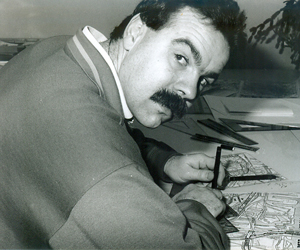
Among the first scientific employees of VBO were also the geodesists Dr.-Ing. Helmut Güttler (geodesist, at VBO from 1971 to 1978; doctoral thesis: "Land use planning according to an optimization model in land consolidation" [Güttler 1978]), Dr.-Ing. Peter Schöttler (from 1971 to 1979) and the graduate geographer Klaus Hoffmann (from 1972 to 1981). In the transitional period after Walter Seele, Hartwig Junius made a stroke of luck and took Heinz Kobs with Brigitte Hower under contract as technical draftsman from October 1975. Heinz Kobs followed and participated in the rapid developments in cartography and land surveying - from rapidographs and light tables to geoinformation systems and digital image processing - with great commitment. This was certainly not always easy and always characterized by the experience that technical progress can, almost overnight, make entire professions superfluous. Heinz Kobs, however, was never superfluous at VBO/BBV.
